West Fork Trail #561 leads to the Continental Divide Trail, however most hikers use the West Fork Trial hike as an out and back. Two suggested lengths and stopping points are as follows: 1) Hike 3 miles to the bridge and return or 2) Hike 5 miles to the hot springs and return. The trail rises more than 600ft in elevation in the first 2 miles of the hike with the first mile winding through private property. Many signs warn hikers to stay on the trail while on private property. Eventually the trail opens up as you enter the National Forest and Weminuche Wilderness.
- Elevation Start: 7988ft
- Elevation at Peak: 8675ft (out and back) 11, 400ft (full hike)
- Trail: One-Way (Can be Out and Back)
- Trail Length: 11.6 miles one way
- Allowed: Hiking, Dogs (Leashed), and Horses
- West Fork Trail #561
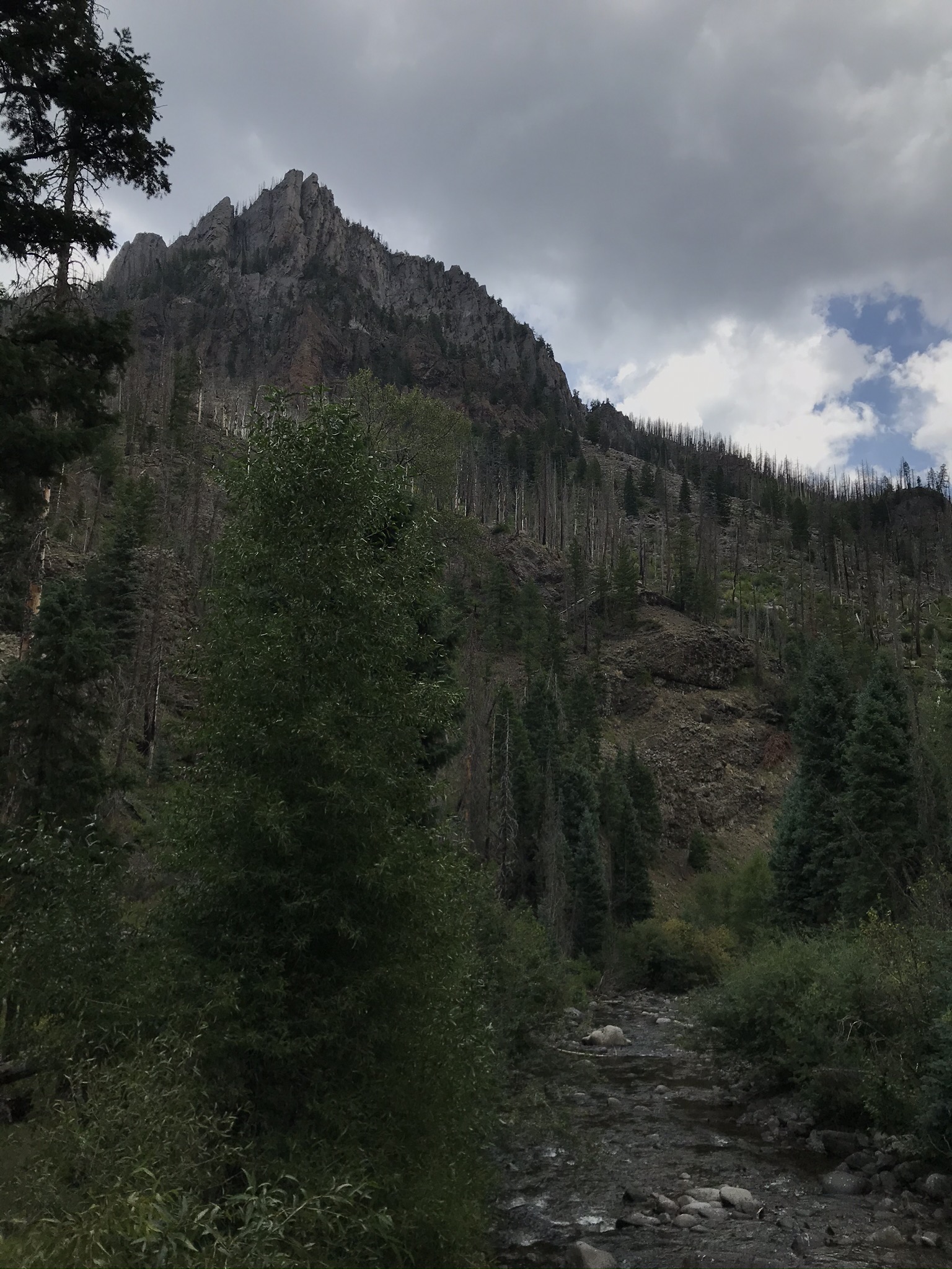
West Fork Complex Fire
Several years ago, in 2013, the West Fork Complex wildfires decimated the area, spreading rapidly due to the beetle kill infestation. Beetle kill is a big problem on the west side of the Continental Divide. As the trees die they become fuel for wildfires. Lightning strikes sparked the fire, and the fire spread rapidly across the dead and dying trees. As a result, the West Fork Complex fire burned over 58,000 acres of the Weminuche Wilderness. The damage is clearly seen, but regrowth has begun. You will hike by new Aspen growth and many ferns and other new growth.
6 Mile Out and Back Hike
A popular version of the West Fork Trail Hike is a 6 mile total round trip hike to the bridge and back. The first mile is through private property and leads uphill to the entrance of the Weminuche Wilderness. The next two miles wander along the hillside above the San Juan River. Approaching the 3 mile marker you will descend to the river where you can see several nice camping sites. Primitive camping is allowed in designated areas within the Weminuche Wilderness is allowed, but you are required to stay at least 100 feet from the river. For a short day hike, the bridge over the West Fork of the San Juan River is a perfect spot to turn around.

10 Mile Out and Back Hot Springs Hike
Rainbow Hot Springs is located 5 miles in on the West Fork Trail Hike. Still within reason for a day hike, the extra 4 miles brings you to a secluded hot spring on the shore of the West Fork River. Hike an extra 2 miles past the bridge until arriving at a path that leads down to the river and to the hot springs. The path is steep, so be careful descending down to the springs. If you enjoy hiking and soaking in hot springs, this combination hike is perfect for you.
The area above the hot springs is also a popular place to camp. Instead of completing the full 10 mile hike in a single day, many hikers pack in overnight camping gear and camp above the hot springs.
Continental Divide
Hiking the full 11.6 mile West Fork Trail leads you to the Continental Divide Trail. At the 6 mile point, past the bridge and hot spring, the trail begins a steep climb upwards towards the intersection with the divide trail at 11,000 ft. Several stream crossings are required before reaching the Continental Divide trail at Piedra Pass.

Directions to West Fork Trail #561
Drive east on US 160 from Pagosa Springs for 15 miles. Turn left on West Fork Road (NFS 648), just before the parking lot for Treasure Falls. Continue driving on West Fork Rd for 2.3 miles. Use the parking lot next to the trailhead. Driving beyond this point, with gate access, is for private owners only.
Google Maps Directions to West Fork Trailhead


Looking for more hikes in Pagosa Springs?