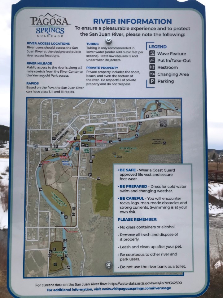
Are you looking for an easy hike or maybe just want to get outside and enjoy some fresh mountain air? The San Juan Riverwalk is excellent choice. It is a paved path along the San Juan River in downtown Pagosa Springs and is perfect for the entire family, including your four-legged family members. There are several places along the trail to access the river for those of you who wish to swim, fish, tube or just get your feet wet. The trail begins at Town Park where you will find ample parking, a playground, restrooms and picnic tables. The trail ends at the Ross Aragon Community Center. From there you can return to Town Park along the trail, or you can take a more direct route via Hot Springs Blvd.
Great views of the Hot Springs
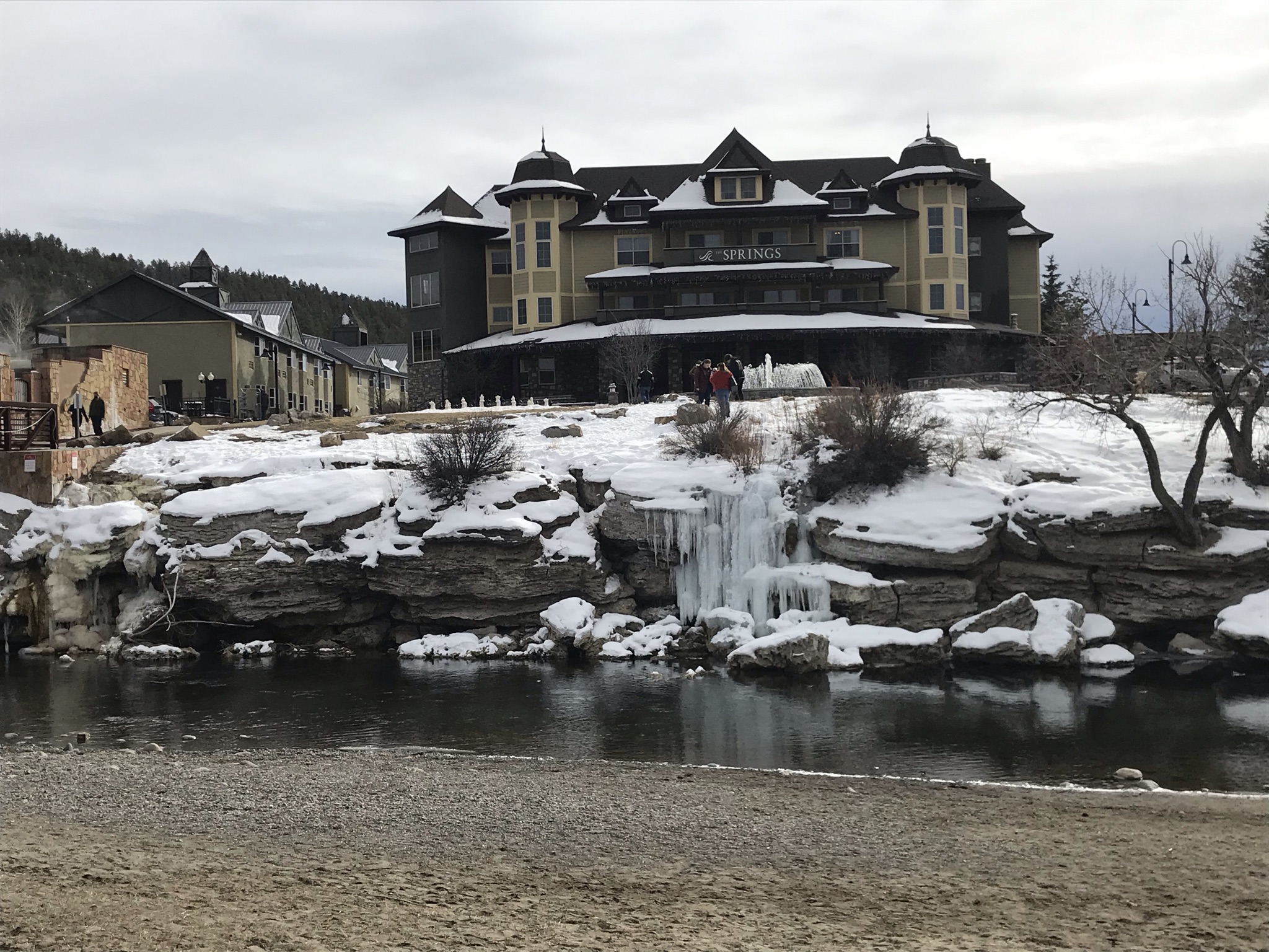
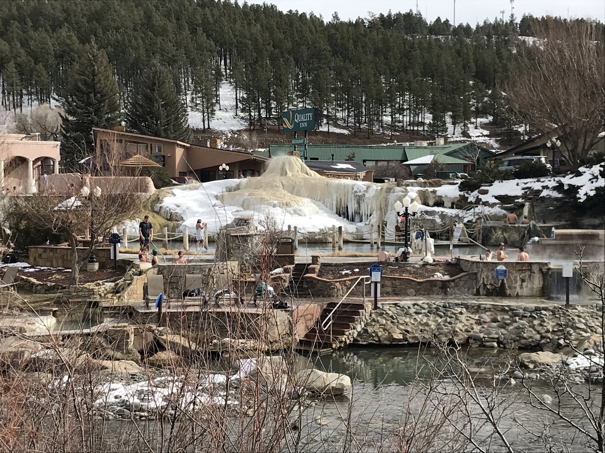
Once you leave Town Park, you will come along several small spring fed pools. These hot spring pools are called “Hippie Dips” and are free for your enjoyment. Just a few yards down the path will be an excellent view of the Hot Springs Resort. It’s a great spot view the resort and all of the different soaking pools. On your right hand side here, you will find stairs and ramps that will take you to the over look area, a prime location in the summer to watch people tubing down the San Juan River.
Centennial Park
Next, the San Juan Riverwalk passes through Centennial Park. The park itself is small in size, however it is comprised of geothermal green houses, or growing domes, a community garden, and a small amphitheater , which sits along the river. Here you can relax and watch the action on the river. Be sure to read the signs explaining how the hot springs are used in the growing domes.
Riverwalk Wetlands
Further down the trail, you will come to the Wetlands Area. The wetlands are also fed by the hots springs, creating a unique water chemistry. This chemistry makes for an unusual biodiversity, which in turn keeps the wetlands area from freezing in the winter and provides a refuge for many species of waterfowl. Signs along the path describe the area and provide a stopping point to learn more about the region.
Safe and clean for everyone’s enjoyment, the San Juan Riverwalk is a must do when visiting Pagosa Springs.


Pingback: Things to do with Kids in Pagosa - My Pagosa Springs